Feeds:
Posts
Comments

Archive for the ‘Wilton’ Category

For those who followed Old Trail Head as he dashed from one park to another to complete the twelve listed walks in the Wilton Go Green sponsored “contest”, you know OTH crossed the finish line just before the deadline with his required walks. He wasn’t the lucky person to win the Cannondale bike in the drawing, but that’s not important. What is important is what did OTH and the the others that participated by visiting the twelve parks/preserves experience and learn? Old Trail Head cannot speak for the others but he’s sure that they, like he, enjoyed the walks and gained a greater appreciation for what a treasure Wilton has in its assortment of open spaces.

So, what are some of the takeaways for OTH from this experience?

  1. There are many parks and preserves in Wilton. The Conservation Commission listed 23 on their web site. OTH added up the acreage (1213) and calculated that about 7% of the total land in Wilton is dedicated to open spaces in one form or another. And OTH knows there are other parcels of accessible open space land that are not included on this web site. At first take the 7% may not seem like a lot, but think about what that real estate might be worth. OTH won’t even hazard a guess. Enough to say that it is sizable in both acreage and value. OTH is appreciative of the many persons over the years that have contributed to this wonderful town asset.
  2. There is quite a variety of experiences to be had out there. Of course there are many miles of trails to walk, though woodlands, wetlands and just about everything in between. Like to ride horses? There are equestrian trails available. Mountain bikes are more your style? OTH saw a lot evidence of trail use by bikers. How about a bag lunch beside a stream or pond? There are working farms to visit, a nature center, and a National Park Service Historic Site. That’s enough to keep you busy for awhile!
  3. Need a trail guide to help with the trails and to know what kind of tree is that (and who doesn’t)? The Wilton Conservation Commission web site has all that waiting for you. OTH’s advice is that a trail guide is always a good thing to have in hand (along with bug spray).

OTH had a great time walking these 12 walks and he knows you will too (click on “Wilton Town Hiking Contest” below). Give them a go.

Now it’s time for Old Trail Head to expand his horizons beyond his home town of Wilton, CT. He will be exploring other great outdoor places in the region. He has several in mind but would like to hear from others about their favorite spots in the outdoors. Send in a comment with yours.

Read Full Post »

Number twelve! Just before June ended OTH was able to take the twelfth, and final, walk in the Wilton Walk in the Woods contest. As previously reported he submitted his form for the July 4th raffle drawings by June 30, as required, but sadly there was no raffle prize for Old Trail Head. But not to worry, OTH will stoically soldier on, walking the trails of S.W. Connecticut, and regions beyond, to bring these enjoyable opportunities to the attention of  seniors and anyone else who might read this blog. But OTH digresses, back to the important stuff, a report on Cherry Lane Park.

This park is located on the eastern side of Route 7 in Wilton, on Cherry Lane, which is reached from Sharp Hill Road (Rt. 106). OTH was somewhat surprised at its size of 50+ acres. For some reason he expected a smaller property. He was also pleasantly surprised at what he found. Cherry Lane Park is a delightful walk. Tall hardwoods cover much of the land, but there is a pond ringed with a loop trail and in the southern portion, there is a wetlands area.

The trail system is the familiar loop around the park (orange) with smaller loops around specific features (e.g. pond, wetlands). Overall there are about two miles of trail available, the orange perimeter trail being .84 miles in length. Near the pond OTH came across two benches and a picnic table, all nicely situated to take in the sights and sounds of nature. As he circumnavigated the pond a bullfrog or two were heard croaking away. OTH made a mental note to bring a lunch to this park soon and take advantage of the picnic table.

Pond in Cherry Lane Park

Pond in Cherry Lane Park

The pond is created by a dam on a stream that the blue trail that circles the pond crosses over.

Dam at Cherry Lane Park

Dam at Cherry Lane Park

Having the pond and a wetlands area combined with stands of hardwoods and conifers Cherry Lane Park offers the walker an abundance of wildlife in a eastern woodlands setting. The benches make it very inviting.

For OTH, it was a very nice way to wrap up the 12 Walk in the Woods series in Wilton. He plans shortly to post a summary of the whole experience with the hope of enticing others to take advantage of the many  open space opportunities there are in Wilton.

For more information, visit Cherry Lane Park.

Read Full Post »

Located in north Wilton, these two parcels adjoin for a combined 56+ acres of woodlands to amble through on an extensive trail system. Unlike many other preserves and parks, there is more than a single loop trail with a few cross trails. Here there are many loops that fit together to form almost a matrix. This extended trail system offers many choices for the walker and it would take several hikes to exhaust all the options available. Depending on the trails chosen, a walk can be essentially flat or include some slopes to descend and climb.

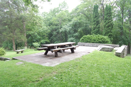
The land is mostly woodlands with many tall hardwoods. There is not much in the way of swampy wetlands, but a couple of streams flow through the area, including Comstock Brook. Two very interesting, and unusual, features of the Quarry Head S.P. are the remains of the extensive quarrying operations done here and the foundations of the Degener family summer residence, in use until 1988. The structure has been repaired for protection and the location offers a view of Long Island Sound, on a clear day. A large picnic table has been put in place and, although he hasn’t yet done it, OTH is dying to have a picnic there sometime. Maybe this October, when the leaves have turned, would be an ideal time for this treat.

Quarry Head State Park

Quarry Head State Park, Picnic Bench & Foundation

Quarry Head State Park, Old Fireplace & Chimney

Quarry Head State Park, Old Fireplace & Chimney


Something that always fascinates OTH on his hikes is seeing the evidence of people and their lives from many years ago. Old foundations, abandoned roads, and rusted machinery are typical examples that one can come upon in the middle of the woods. The rock walls that abound throughout New England are also part of this, although they are so common that it’s easy not to really notice them. The foundation and chimney at Quarry Head are in this category as well, albeit they were in use less than 25 years ago. Also there, a short distance from the foundation, is an old tennis court. It is now “serving” as a bed for wild flowers and, unless regularly cleared, will return to the woodlands that surround it.
Quarry Head State Park, "Once Upon a Time" Tennis Court

Quarry Head State Park, "Once Upon a Time" Tennis Court

Over the years OTH has been to these two spaces a number of times and they remain one of his favorite places in Wilton to walk.

For more information, visit Quarry Head State Park and Harrison Smith Preserve.

For those keeping score, Old Trail Head did complete the 12 walks of the Wilton Walk in the Woods contest, but alas, his name was not selected for any of the 13 raffle prizes. Of course that really wasn’t the purpose of the exercise. OTH enjoyed the walks and it got him to many places he hadn’t been in a while and even to a few new ones. He will post the last walk, Cherry Lane Park, shortly.

Read Full Post »

Located in north Wilton, along Ridgefield Road, these three parcels join to form one large nature preservation area (about 77 acres). Several trails extend into the three areas so it’s easy to travel through all of them on a single visit. As with many areas of this size, there is a basic loop trail (orange and white in this case) with options and cross trails available to add variety and shorten/lengthen any given walk.

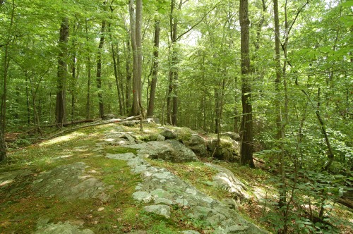
OTH entered from Ridgefield Road and parked in the designated area. Flipping a mental coin, he began the loop hike in a counterclockwise direction which took him almost immediately up a small grade and across a ridge. In this elevated terrain, there was little underbrush and the tall timber gave it a real eastern woodlands feel.

Orange Trail Crossing a Bedrock Ridge

Orange Trail Crossing a Bedrock Ridge

Leaving the ridge, the orange trail dropped down into a wetlands area, crossing a wooden bridge over a small steam. As he approached the bridge, OTH saw two large birds high in the trees. They may have been hawks, but he feels they might have been owls. There was too much foliage and the birds were moving too quickly to get a good look. Later OTH will show you a different bird that isn’t so hard to see, or photograph.

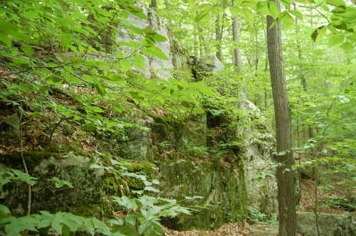
The blaze color changed to white after the bridge with a choice of a longer or shorter route. OTH choose the shorter distance because he had another walk to make that afternoon (pressure to complete the 12 hikes in the Town Walk in the Woods contest).   One of the interesting sights along this section was this rock face. Not being a geologist, OTH cannot tell you what kind of rock made up this outcropping. OTH continued the loop and finished the walk back at the Ridgefield Road entrance.

Large Rock Face on White Trail

Large Rock Face on White Trail

As mentioned above, there are many options available in this combination of three preserves. In addition to the trail options, the hiker will walk through open woods populated by tall hardwoods and pass through wetlands filled with various shrubs and often red maples. There is some up and down walking but nothing too strenuous. There probably is around 2.5 miles of trail available in the three preserves. When you go here, be sure to retrieve both of the available descriptions and trail maps from the Wilton Conservation Commission web site (see below).

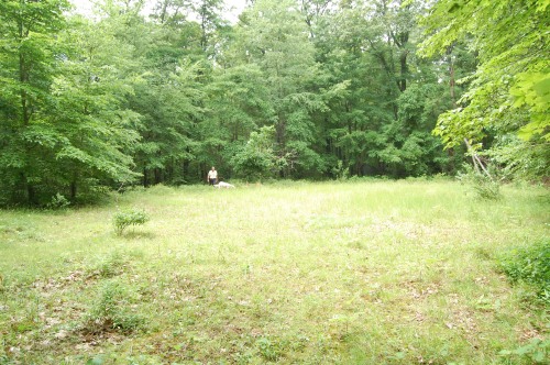
Oh yes, the other bird. Actually there were five other birds, turkeys roaming the field near the parking area. They really are BIG birds when you get close to them.

Turkey in Sackett Preserve

Turkey in Sackett Preserve

For more information visit Sackett and Marble/Van Haelewyn-Richards Preserves.

10 down, 2 more to go.

Read Full Post »

OTH continues his march toward completing the 12 walks in the Wilton “Take a Walk in the Woods” contest. On Sunday, June 26 he visited the Belknap & Gregg Preserves, located in the northeastern part of Wilton. While the preserves are two different parcels of land, they abut and share a path. So one may park at one of the preserves, walk through it, cross over to the other preserve, walk through that one and then return to the parking area. This “two preserves in one” aspect and the size of them (about 110 acres) offer a more extended walking experience. The last few parks that OTH visited offered essentially one loop trail with a few cross trail options. The Belknap/Gregg combination offers a more of varied set of trails, particularly the trail system in the Gregg Preserve. OTH recommends a hiker come with a trail map in hand (actually a good recommendation for almost any hiking or walking experience in the woods).

On this day, OTH parked at the Belknap Preserve entrance on Wampum Road. He took a path diagonally  across the preserve to reach the point of entry into the Gregg Preserve and then walked along the Mayapple Brook for a short stretch. A loop path around a wetlands portion took OTH back to the point of return to the Belknap Preserve. He finished by taking the loop trail back to the parking area, all-in-all about 2 miles, he reckons.

One of the notable features of these preserves, particularly the Gregg Preserve, is Mayapple Brook. Various paths cross and follow the stream as it meanders through the woods. OTH finds the experience of walking along or crossing over brooks and streams such as Mayapple Brook, particulary pleasing, and hopes you do as well.

Mayapple Brook in the Gregg Preserve

Mayapple Brook in the Gregg Preserve

While returning along the blue loop trail in the Belknap Preserve, OTH encountered one of Wilton’s deer. He cannot quite understand his fascination with this kind of experience. Lord knows he has seen deer all over Wilton and cursed the animals as he stood over the bare stalks of hosta, but nevertheless, OTH gets a thrill when he and the deer stare at each other for a few seconds. That and seeing it bound away, gliding effortlessly over fallen trees, white tail held high as it disappears into the trees are high points of any walk where it happens.

Deer in Belknap Preserve

Deer in Belknap Preserve

A couple of tips or thoughts on these two preserves:

  1. The yellow trail in the Belknap Preserve evidently doesn’t get a lot of traffic. Usually in these parks, the trails are discernible paths. Not so with this one, it’s well marked enough with yellow blazes, but you got to be careful to follow them. OTH was strolling along and realized he’d lost sight of blazes and did not have a path to follow. It was easy to retrace his steps a short distance and get back on the trail, so no great damage was done, but just keep the blazes in sight as you walk.
  2. In the Gregg Preserve, OTH noticed that the trail intersections were well marked but, at least on some of the trails he walked, the trail itself was not blazed.  Maybe he missed them, but he did not see any. Not a big problem because, unlike the yellow trail in the Belknap Preserve, the trails were fairly easy to follow. A few blazes though would be handy to confirm you are where you think you are. Again, same message, keep your mind in gear as you walk and know where you are as you go.

So, OTH recommends these two reserves for something more than a short midday nature walk. The extensive trail system in the Gregg Preserve with the addition of the Belknap Preserve provides an opportunity for a hike of several miles. Like most of the open spaces in Wilton, there is a combination of woodlands and wetlands. The ever-present rock walls are there as well.

For more in formation visit Belknap Preserve and Gregg Preserve.

9 down and 3 more to go!

Read Full Post »

OK, how’s this for an idea? Go to one of your favorite deli counters in Wilton and pick up sandwich, or whatever is a good takeout lunch for you, and mosey over to Schenck’s Island. Heck, you can walk there from anywhere in Wilton Center. For this excursion the other day, OTH picked up a salami on pumpernickel, his favorite sandwich, and a soda at the Village Market. A few minutes later he was enjoying a quiet lunch beside the Norwalk River, a stone throw from busy Wilton Center (literally).

Salami Sandwich

Salami Sandwich on Schenck's island

Schenck’s Island, though technically not an island, receives such a designation due to the fact that the Norwalk River on its west and south sides and the railroad tracks along its eastern boundary isolate it like an island. The main trail system at Schenck’s Island leads visitors in a loop around the island. There is also a side trail that parallels the Norwalk River (this is where OTH had lunch). Clearings made along the River provide excellent sites for fishing, picnicking or relaxing by the water’s edge.

The trail guide says there is about one mile of trails. That sounds about right. In the past OTH has seen fly fishermen working the stream, about 70 yards from a Starbucks, but you wouldn’t know it! On this walk he saw a white-tailed deer, not unusual in Wilton, but it was too far away (and too quick) for a photo.

How long does it take to walk a mile, 20-25 minutes? Add another 15-20 minutes to have lunch and relax a bit and you’ve got a perfect lunch break. Right in the heart of Wilton. Can’t beat that.

Norwalk River

Norwalk River at Schenck's Island

For more information and a trail map visit the Wilton town web site.

Black Farm
This is also on the Town of Wilton Hiking list but when OTH went there the two public entrances were chained shut. He tried a private driveway, hoping he could quickly get into the public meadow area, but that didn’t work so he quickly left the private area (people live there). So it wasn’t a long walk but a walk nevertheless and he’s counting it!

Six down, six to go.

Read Full Post »

Over the weekend OTH continued his quest to complete the Wilton Hiking Contest list of open spaces to hike. On Saturday it was the Woodcock Nature Center. The Center is located on a large tract of land owned by the State of Connecticut. The bulk of the property lies in Wilton, with the remaining acreage in Ridgefield. The land is primarily wetlands; however, a small portion of the site, located at the north end of the property, is uplands. It is on this part of the land that the Nature Center building and trails are located. The land was acquired by the State over a period of about 15 years for the purpose of flood control following the devastating effects of the 1955 floods. A flood control dam constructed in 1972 at Spectacle Brook impounds water during heavy rains.

Facilities include a nature center and a roofed picnic pavilion. When OTH was there somebody had a party going on in a sandbox play area for about a dozen young people in the 4 to 5 year age range. Probably a birthday party. The pavilion looked like it was setup for a party. All-in-all a pretty good idea.

And speaking of the nature center, before his walk OTH snapped a couple of photos of local residents.

Barred Owl

Barred Owl

Great Horned Owl

Great Horned Owl

Sorry about the wire cage, but the birds are contained. There was also a red tailed hawk but when he saw my camera he hid behind a wood screen. Camera shy I guess.

The hiking opportunity is essentially one loop trail with some cross trail options. OTH saw a number of strategically located benches to stop, rest and take in Mother Nature. As with all the Town hikes so far, the key to enjoyment is taking your time and stopping to absorb the scene. Woodcock Nature Center is no exception. According to the town trail guide, the total trail length, including the cross trails is 2.5 miles. OTH thinks there may have been additional trails established since the trail guide was published. Either way, there is no urgency to rush the trip!

Woodcock Trail

Woodcock Nature Center Red Trail

Visit the Wilton town web site for more information and a trail map.

Four done, eight to go.

Read Full Post »

OTH went over to the Grassi Property on Tuesday for his next walk in the Wilton Hiking Contest (he seems to be hitting the convenient trails first). This is a 71-acre parcel extending from Millstone Road to Whipstick Road for the entire length of Tito Lane. The property was preserved by the Town and the Grassi Family in 2001 when the town purchased easement covering some 62 acres of the site. This property is now also the location of Millstone Farm and OTH will add more on this below. Hiking the Grassi Property is not complex. There is one trail, a circular path through the wooded northern portion of the property. One must be watchful of where one places their feet as they walk along; in addition to a hiking trail, the path is also an equestrian trail, (enough said). The trail is complete with jumps, but not to worry, hikers can walk around them. (more…)

Read Full Post »

Over the weekend OTH learned about the Wilton Town Hiking Contest, for the first time. From what he read in the Wilton Bulletin, it looks like this contest has been in place since last October! It was due to end on April 25, but because of all the rain, it has been extended until about the end of June, (OTH not sure). What rock has OTH been living under!

To compete, individuals are to walk in 12 different open spaces in Wilton, or as many as they can get to. Entry forms are available at the Conservation Commission office in the town hall annex or online at wiltongogreen.org/eventsprograms. The contest is sponsored by Wilton Go Green in partnership with the Wilton Library, Wilton Family Y, Alliance for a Healthy Community, Wilton Conservation Commission and Wilton land Trust. Quite a line up. A drawing will be held on July 4 to select the winners. For more information check the call Environmental Affairs @ 203.563.0180 or email info@wiltongogreen.org.

There’s not a lot of time left but OTH is going to give it a try. He figures his garden walk at Weir Farm on Saturday takes care of that square. Today he went over to the Town Forest to walk down to one of his favorite spots, the Sheep Falls. No one is going to confuse Sheep Falls with Niagara Falls, but it’s pleasant place to listen to the water as it drops down across several rock outcroppings. Legend has it that one of the early farmers in the area used the falls to wash his herd of sheep. Works for OTH.

Sheep Falls

Sheep Falls

A few facts about the Wilton Town Forest. It encompasses 188 acres in north Wilton. There is a network of trails that provide a nice variety of walks and different levels of effort required. Although none of them are very demanding, there are some grades to climb or descend. The Sheep Falls are in the northern end of the property. Trail maps are available for the Town Forest and all town open space at http://www.wiltonct.org/departments/conservation/conservation0.html.

OTH will keep everybody apprised of his progress toward the goal of walking all 12 open spaces.

Read Full Post »

On Saturday OTH returned to Weir Farm to walk through the three gardens that are now part of the Historic Site. He can definitely recommend this short walk to anyone looking for a moment or two to relax and enjoy the tranquility of a quiet garden setting, or in the case of the Weir farm, three garden settings.

From the The Gardens brochure:
“For many affluent New Yorkers of the 1880’s, there was a strong desire for a tranquil retreat from the noise and heat of the city. J. Alden Weir was no exception. He acquired his Branchville property in 1882, and soon developed a deep affection for the landscape of his new country home. Over the years the gardens became a significant and endearing part of this rural landscape.”

Weir Farm Terraced Gardens

The Terraced Gardens

The Terraced Gardens
Even thought the NPS refers these in the plural, OTH considers these terraces as one garden (one of three). And they offer an opportunity to sit and take in a wide view of much of the farm, including many of the buildings, parts of several meadows, and, of course the terraced gardens themselves.

Weir Farm Sunken Garden

Sunken Garden

The Sunken Garden
The Sunken Garden, a few steps from the Visitor Center, was actually a creation of Weir’s daughter  Cora after she took possession of the farm in 1932. It had fallen into a state of shambles when the NPS acquired the property in 1990, but has since been restored as close as possible to the garden Cora had built in the 1930’s.

Weir Farm Secret Garden

Entrance to the Secret Garden

The Secret Garden
OTH finds this garden the most intriguing of the three, if for no other reason, this one is not next to the Visitors Center. Not that it’s much of a walk to see it, but one must decide to go there, or stumble on to it while just walking around the grounds. Like the other gardens, it has a selection of plantings that keep something in bloom most of the summer.

Open House June 11
As part of the Connecticut Open House Day, the Weir Farm Historic Site will be holding an Open House Day on June 11. This will be an unusual opportunity, not only to see the the grounds, but to have a look at several buildings that are now going through a lengthy restoration process, including the main residence and studios. The NPS staff will show and describe the restoration process to visitors on this Open House Day. these building are otherwise closed to the public while this restoration process is in process. The Open House hours 10:00 am to 4:00 pm. Call 203.834.1896 ext. 13 for more information.

Read Full Post »

Older Posts »